Trusted across eight core industries.
Purpose-built drone workflows tuned to the exact needs of your sector.
Agriculture
Crop health monitoring, precision spraying, yield estimation and end-to-end precision farming solutions.
Construction
Site surveys, progress tracking, safety audits, 3D data capture and BIM-ready deliverables.
Real Estate
Cinematic aerial photography, virtual property tours and marketing content that sells.
Infrastructure
Roads, bridges, pipelines, railways and utility asset inspections with accurate reporting.
Mining
Volumetric surveys, pit mapping, haul road optimization and stockpile monitoring.
Solar
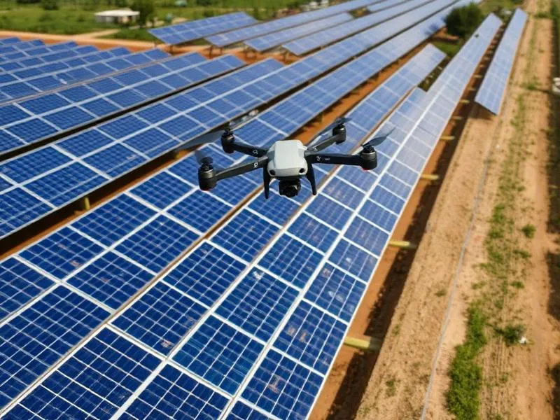
Thermal and RGB inspection of photovoltaic plants at scale to detect defects and hotspots.
Government Projects
GIS mapping, land records, disaster assessment and public infrastructure audits.
Telecom
Tower inspection, line-of-sight surveys, network planning and maintenance documentation.
Purpose-built drone workflows for the industries that power India
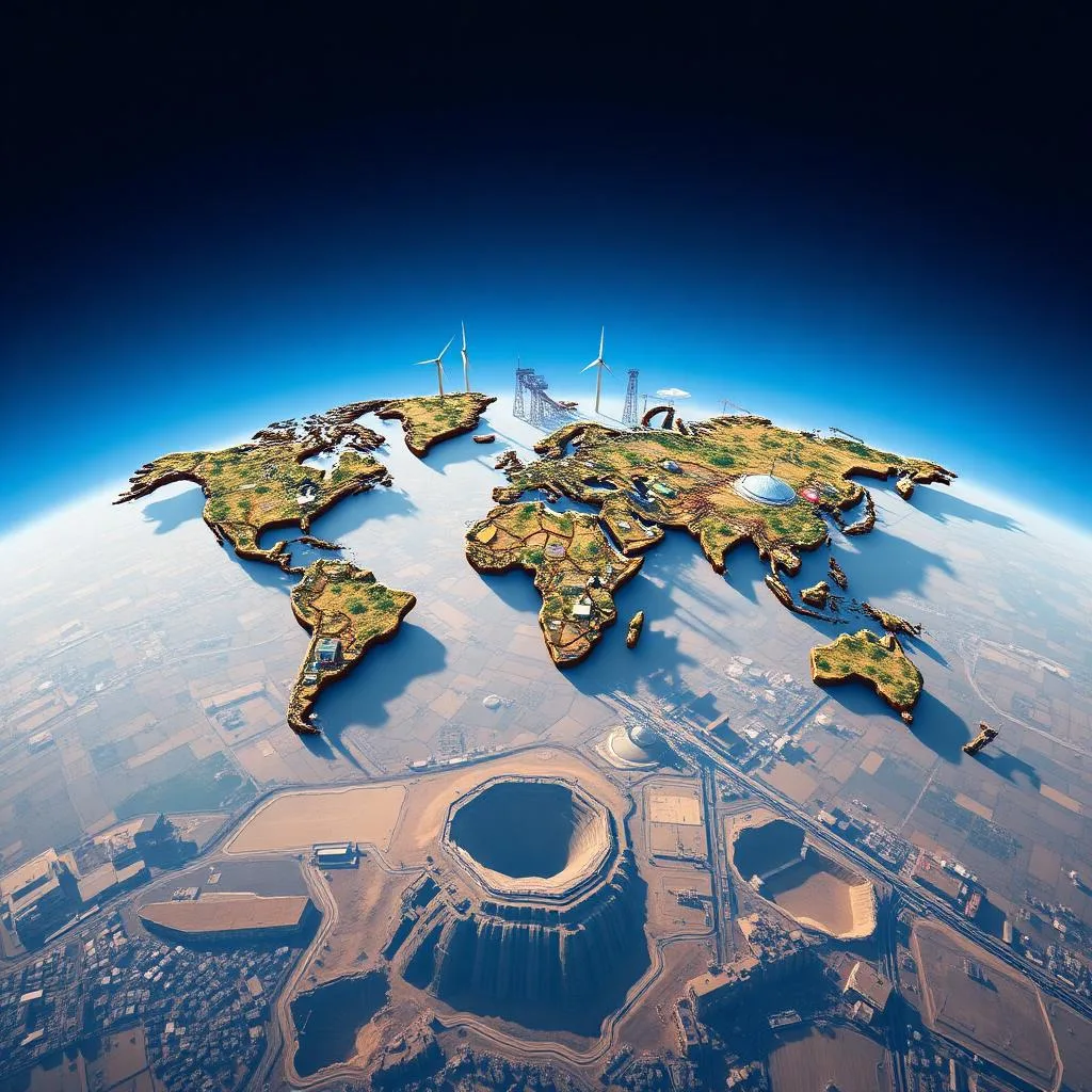
Every industry sees the sky a little differently. A farmer wants to know which corner of the field is thirsty. A construction owner wants to know whether the raft is on schedule. A solar operator wants to know which module is dragging plant yield. A telecom manager wants to know whether the tower's guy-wires are still true. At Dronix Pro we do not force a one-size-fits-all workflow onto every client — we tailor our aircraft, sensors, flight patterns and deliverables to the specific decisions your industry needs to make.
Agriculture
Precision agriculture is the single fastest-growing use case for drones in India, and for good reason. A well-executed drone programme raises yield, reduces input cost and slashes the health risk of manual chemical handling. Our agri stack covers multispectral crop-health mapping (NDVI, NDRE, GNDVI), variable-rate prescription generation, tank-mix spraying, seed broadcasting and post-harvest yield estimation.
We work directly with farmers, cooperatives, FPOs, agri-input dealers and state agriculture departments, and our pricing is calibrated to be affordable at the individual-farm level while scalable to thousand-hectare estate contracts.
Construction and real estate
From pre-tender site surveys to weekly progress monitoring to marketing-launch films, we support projects across their full lifecycle. Our BIM-compatible deliverables plug straight into Revit, Civil 3D and ProjectWise, and our marketing edits are built for the exact aspect ratios your sales team needs.
Infrastructure and public works
Highways, metros, bridges, ports, pipelines and canals. We provide baseline corridor surveys, alignment optimisation studies, construction-progress monitoring and post-commissioning inspection. Our teams have flown missions for state PWDs, NHAI contractors, urban development authorities and rail corporations.
Mining and quarrying
Repeatable, auditable volumetrics are the reason mining operators call us back every month. We capture the pit, process to a dense point cloud, calculate stockpiles and haul-road volumes and deliver a signed report suitable for royalty submission and financial audit. Safety benefits are equally significant — nobody has to walk across an unstable stockpile with a total station.
Solar energy
Solar plants live and die on availability. Our radiometric thermal inspection catches failing modules, diode issues, PID and soiling long before they show up in generation reports. Standard turnaround for a 50 MW plant is a week; rush inspections for warranty deadlines are available on request.
Government projects
Land records digitisation, panchayat boundary mapping, disaster-response reconnaissance, heritage documentation and public-infrastructure audits. Every government engagement is delivered by pilots who carry hard-copy DGCA credentials and site-specific permissions.
Telecom
Cell-tower inspection, line-of-sight validation for microwave links and 5G small-cell planning. Our tower workflow captures antennas, feeders, guy-wires, obstruction lights and shelter condition in under thirty minutes per site, replacing a full day of rope-access work.
Media, entertainment and events
Feature films, TV commercials, music videos, weddings, concerts, sporting fixtures and political rallies. Our cinematographers understand story as well as they understand airframes, and every shoot is planned around the director's brief rather than around the drone.
A workflow tailored to your decision, not our fleet
The through-line across every industry we serve is that we start with your decision, then work backwards to the flight. What does the deliverable need to prove? Who signs off on it? What accuracy is required? What format is easiest for your team? Only after those questions are answered do we pick the aircraft, the sensor and the flight plan. That habit — designing backwards from the decision — is what turns a drone flight into aerial intelligence.
If your industry is not listed here, ask us anyway. Some of our most rewarding engagements have been in sectors we had never flown before.
Ready to see how a tailored drone workflow fits your industry? Reach out via WhatsApp or the contact page — a senior team member will call within one working day to discuss scope, timing and price.
Industry deep-dives: how our workflows adapt to your sector
Every sector has its own vocabulary, its own regulatory environment and its own definition of a successful deliverable. This section goes one level deeper into how our workflows are tuned to the industries we serve most frequently, so your team can see exactly what to expect from a Dronix Pro engagement in your context.
Agriculture — from scouting to spraying to yield estimation
A typical agriculture engagement begins with a multispectral scouting flight producing NDVI and NDRE maps that highlight stressed zones invisible to the naked eye. Those zones are validated against ground observation, converted into a variable-rate prescription map, and executed by our purpose-built spray drones at ten to twelve acres per hour. Post-spray, coverage reports confirm exactly how many litres were applied where. For estate and FPO clients, a full-season dashboard tracks yield estimates, chemical consumption and cost savings against baseline.
Construction — the weekly capture cadence that changes projects
The single highest-impact change we bring to construction sites is the weekly capture cadence. A short flight every Saturday morning produces an orthomosaic, a progress overlay against the master plan and a two-minute cinematic edit for the client's board pack. Over the life of a project, that cadence dissolves ambiguity around schedule, material logistics and safety compliance — and it produces a permanent visual record that is invaluable for dispute resolution.
Solar — inspection cycles tuned to your warranty calendar
For solar operators, the timing of inspection is as important as the technology. Warranty windows, seasonal soiling patterns and inverter maintenance cycles all influence when a thermal inspection produces maximum insight. We work backwards from your calendar to design an inspection programme — typically one comprehensive inspection per year plus targeted quick-scans after major weather events — that catches defects when they still qualify for warranty remediation.
Transmission and telecom — inspection without shutdowns
Every hour of scheduled outage costs a utility real money and risks unplanned outages costs even more. Drone inspection removes the need for line shutdowns and manual pole climbs across the vast majority of tower and conductor inspection tasks. Our zoom-and-thermal workflow captures the entire tower — antennas, feeders, guy-wires, insulators, clamps, obstruction lighting — in under thirty minutes per site, with defect-tagged reporting that maintenance teams can act on immediately.
Mining — auditable volumetrics month after month
Mining clients care about two things: accuracy and repeatability. Our monthly volumetric workflow uses the same flight plan, the same ground control network and the same processing pipeline every cycle, so month-on-month comparisons are truly like-for-like. Signed volumetric reports are formatted for royalty submission and third-party financial audit.
Government — process discipline that matches yours
Government engagements demand meticulous documentation. We arrive with hard-copy DGCA credentials, site-specific permissions, insurance certificates and a written risk assessment. Deliverables are formatted for direct integration into GIS platforms and land-record systems. And every mission is executed by pilots who understand that a government audit will follow the flight — because we design the flight to survive that audit from the outset.
Media and entertainment — cinema over spectacle
For film, television and event work, technical excellence is table stakes; what actually separates a great aerial cinematographer from a competent one is storytelling. Our creative team plans drone moves alongside your ground crew, contributes to storyboards, and delivers colour-graded edits that support the director's vision rather than distract from it.
How to start a conversation
Whatever your industry, the fastest way to see whether we are the right partner is to send a two-line brief through the contact page or over WhatsApp. Within one working day a senior member of our team will reply with a rough scope, an indicative price band and the next available flight window. If a drone is not the right answer for your problem, we will say so honestly — that too is what a good industry partner does.
Emerging use cases and cross-industry patterns we are seeing
Our operations team keeps a running log of new use cases as they emerge from client conversations. Some become full service lines. Others remain niche but rewarding one-off missions. This section describes the cross-industry patterns we are currently watching, and the emerging use cases where drones are quietly transforming decisions that used to require guesswork or expensive fieldwork.
Insurance, risk and asset verification
Insurers increasingly rely on drone-captured evidence for pre-underwriting inspection, post-claim assessment and periodic asset revalidation. We support insurance clients across property, industrial and agricultural lines with rapid mobilisation, standardised deliverable formats and clear chain-of-custody documentation. For catastrophe response — floods, cyclones, fires — we prioritise on-call mobilisation to help insurers assess damage inside days rather than weeks.
For asset-heavy businesses, periodic drone-based asset verification is now a viable alternative to manual audits for stockpiles, tank farms, tower portfolios and distributed solar assets. The savings compound quickly once the workflow is set up.
Environmental monitoring and coastal management
From coastal-erosion tracking along Tamil Nadu's shoreline to catchment mapping in the Western Ghats, environmental applications of drone imagery are growing rapidly. Multispectral and thermal payloads let us capture vegetation health, water-body extent and turbidity indicators over large areas at a fraction of the cost of ground surveys. For NGOs and government agencies, we design low-cost, repeatable monitoring programmes that can be sustained across multiple years.
Wildlife counts, protected-area boundary verification and human-wildlife conflict mapping are other applications where our aerial workflows are contributing meaningfully to conservation science.
Heritage documentation and cultural preservation
India's temples, monuments and heritage precincts are aging faster than they can be manually documented. Drone-based 3D capture creates photorealistic digital twins that can support conservation planning, restoration design, scholarly research and cultural tourism. We have supported temple documentation projects across southern Tamil Nadu and would welcome the chance to contribute to more.
Every heritage engagement is designed around the sensitivity of the site — flight altitudes, times of day and community consultation are all tailored so the technology is a respectful contributor rather than an intrusive one.
Smart-city and municipal applications
Urban local bodies are beginning to explore drones for solid-waste-dump volumetrics, traffic and parking studies, unauthorised-construction detection, stormwater-drain mapping and disaster-response planning. Our municipal engagements are designed for auditability, integration with existing GIS platforms and secure handling of citizen-facing data.
If your organisation is exploring a use case that does not yet have a standard vendor market — insurance, environmental, heritage, municipal or something entirely new — we would love the chance to design a pilot with you. Some of our most rewarding engagements have been in exactly these emerging spaces.